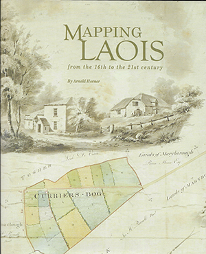
MAPPING LAOIS FROM THE 16TH TO THE 21ST CENTURY
Published in Book Reviews, Issue 2 (March/April 2019), Reviews, Uncategorized, Volume 27ARNOLD HORNER
Wordwell Books
€30
ISBN 9781999790
Reviewed by Matthew Stout
Matthew Stout lectures in the School of History and Geography, Dublin City University.
 Arnold Horner is a giant in the field of Irish historical geography and he is revered by two generations of geography students at UCD as an inspirational teacher. In recent years his passion for cartography has given rise to a number of publications on individual maps of Irish counties—William Larkin’s maps of Sligo, Meath and Offaly—and dozens of articles on aspects of pre-Ordnance Survey cartography. This new book is, however, his most sustained and accomplished.
The first impression of Mapping Laois is that it is a masterpiece of book production. It is beautifully printed, and even if there were not a single word in it I would still recommend it for the sheer quality of the layout and the range of maps reproduced. But don’t let the beauty of this book fool you: it is foremost a great work of scholarship on the maps of Laois.
No county in Ireland is better suited for a study of its cartography owing to the fact that Laois was the subject of Ireland’s earliest and most fascinating topographical map. The map that accompanied the sixteenth-century plantation of the county provides just one of many valuable lessons in this book. The path of mapping is not a continuous line of progress. This first map is like an aerial view of the county, with its bogs and its woods, churches and clearings and routeways, but it would be three centuries before anything as accurate, comprehensive and convincing would be produced again.
This first map also shows us how things can endure in the landscape, for example the fort at Maryborough (modern-day Portlaoise). It is there in the 1550s, in the Grand Jury map of the county from 1805, in the Ordnance Survey fair plan of 1840 and in numerous revisions into the twentieth century. Then, after the foundation of this state, the fort becomes lost beneath the foundations of a vocational school. But for centuries it was as if nothing could grow on the plantation-wounded landscape.
It is a commonplace now that maps are about power and that the history of mapping in Ireland is the history of the colonial process. That, too, is reflected in this book. Oliver Sloan drew a map of the county in 1763 and depicted only a single Catholic church when there were probably more than two dozen. There is an entire population excluded from these maps of the landlord’s world, but what an extraordinary world it was while it lasted. It is impossible to escape the allure of the estate maps (for all the inequality that they express), and in this book the reader will marvel at how a landscape was so meticulously transformed and then so pleasingly depicted on its maps.
There is a palpable sense of the hidden potential of the eighteenth-century Irish landscape—just out of reach, just beneath the surface. Arnold Horner’s animated prose captures these exciting, optimistic and improving times. And it was an optimism that took an incredibly long time to dissipate. They brought the canal to Mountmellick in 1831 to carry the goods produced in ‘the Manchester of Ireland’ (imagine!—Mountmellick, the Manchester of Ireland!), but never quite got the canal as far as the coal-seams in the south of the county, although maps preserved the existence of a mining settlement built by the canal company in anticipation of the canal getting there. As late as 1912 a map was drawn showing the proposed railway designed to unleash the imagined potential of the Laois coalfields. Anything seemed possible in pre-Famine Ireland, including the construction of a round village proposed for Timahoe. Unfortunately it was never built.
Just two of the hundreds of maps in this volume demonstrate the importance of Laois cartography as a source for Irish history far beyond the county boundaries. The racecourse at Kilmorony, where once the horses of the gentry ran, was by 1839 parcelled out into plots for potatoes, oats and turnips. The map is unadorned, reflecting a new, harsher reality. Elsewhere in Laois, Horner notes that the viewing stand of the racecourse on the Heath is ‘in ruins’ on the 1841 OS map. He writes simply: ‘Times were changing’. Indeed they were.
Fast-forward to a map from the Valuations Office. It is a much-annotated large-scale plan of Portlaoise and it shows the Catholic church built there in 1965. The church is drawn in great detail and beautifully hatched by hand. Horner points out that ‘its footprint stands in sharp contrast to the smaller buildings and properties nearby’. And it looks like a footprint, the footprint of the new colossus that marched across the landscape of the new state. Could there be a better example showing how maps are expressions of power?
There is much in this book in addition to the maps and text. Mapping Laois incudes a comprehensive atlas of the county and a complete catalogue of the maps of Laois. Horner has discovered many new maps by searching through the private libraries in Britain of the great families who once held land in Laois. Critically, this book achieves three separate goals: for those interested in maps it provides a history of the mapping of all of Ireland through the lens of a single county; it tells the story of an Irish county through the lens of its maps; and, ultimately, it becomes a history of the Irish landscape as told through the lens of a single county’s maps, brought together here between the covers of this beautiful and insightfully written book.