The three primary dynamics of medieval society were the control of the production of wealth, the raising of armies for war, and the administration of justice for the achievement of civic order. Such functions did not operate in a vacuum but used a hierarchical spatial system, or a system of local, regional and provincial territorial divisions, to discharge their role. These divisions linked the micro with the macro, or the local with the national. In the early medieval period in Europe such systems tended to be unique to each state or country, being much influenced by local particularism in their early development. As time progressed and the international economy developed, parts of the systems of the more affluent and advanced states were increasingly exported to the less advanced states. Although the Frankish empire fragmented during the ninth century, its system of administration, the feudal system, became the dominant one in Europe, spreading widely from its homeland in France, Germany and the Low Countries. The spread of this system into the more peripheral regions of Europe was gradual, and here the survival of other systems lasted longest. In Britain and Ireland the feudal system was introduced and promoted by the Norman invaders, who first arrived in England in 1066 and a century later in Ireland.
Irish sense of place
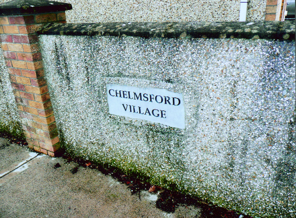
The well-known Irish ‘sense of place’ is, perhaps, a value that descends from the strong element of localism seen in this medieval Irish administrative system. The Irish attachment to such units as the townland, parish and county is well attested, and kept alive in particular by the divisions used for forming teams by the GAA. This sense of place was also a factor of the largely rural, peasant nature of our society until a few generations ago, where families remained tied to the same piece of land or district for centuries, as demonstrated by surname distribution patterns. Behind this Irish attachment to our local divisions lies a rich history of development and decline through which elements of our indigenous system long endured, often in disguise. These divisions are part of who we are as a people, and deserve study and recording.
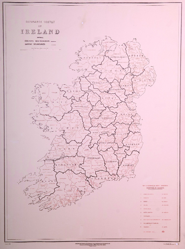
Historians will be aware of the standard system of place-location bequeathed to us in its present form by the original Ordnance Survey of the first half of the nineteenth century. From bottom up, this hierarchical system gives townland, civil parish, barony, county and province. Remarkably, all of these divisions owe something to our pre-Anglo-Norman indigenous system. Our townlands are often based on the subdivisions (halves, thirds, quarters, eighths) of that poorly understood Gaelic Irish estate, the baile. This was the taxable unit of landholding in pre-Norman Ireland, the basic property unit of lineage groups.
The baile often acts as the template for the original parishes of the twelfth and thirteenth centuries, especially in the more fertile parts of Munster and Leinster. Other, generally larger, parishes were based on the area of the túath, groups of which together comprised the unit known as the triúcha céad. This latter unit is often the ancestor to our modern barony, via the intermediate stage of the Norman cantred. Many of our counties derive their shape ultimately from regional kingdoms, groupings of which in turn gave us our provincial kingdoms, ancestors to our modern provinces.
Counties
Pride in county is particularly strong among the Irish. Our counties demonstrate a disparity of origins, some echoing 1,000-year-old political divisions, others similar sixteenth-century divisions, and yet others the result of mere English administrative line-drawing. The term ‘county’ was introduced to Ireland by the Anglo-Normans, who created about a dozen of them in the areas they settled. Norman counties usually faithfully reproduce the shape of older Irish kingdoms, unlike the later sixteenth-century counties created by the English. Our modern county structure was finalised by this English Tudor restructuring to give us our present 32 counties. The term itself is a Frankish one, deriving from the officers or magnates (‘counts’) who ruled each administrative district (‘county’) under the Frankish kings in France. By the time it arrived in Ireland it had lost some of this meaning, coming to refer to a primary administrative district, normally under the control of the sheriff, a word of Anglo-Saxon origin. It is to the second, Tudor, period of enshirement that we owe most of our modern county boundaries. Unfortunately, this ‘New English’ (to stretch this term a little) enshirement paid scant attention to more traditional boundaries—which were often remembered—and concentrated on the political borders, which in some cases had emerged only very recently. Even where these new counties did reflect the boundaries of older kingdoms the English were sometimes careful not to use the old name, as in the example of County Donegal, which masks the older kingdom of Tír Chonaill, or County Clare, which does duty for Thomond. A few older kingdom names did survive this censorship, such as Tyrone (Tír Eoghain) and Fermanagh (Fir Manach).
Such historical developments are of interest in view of the strong pride in county that we see today. A good example is that of Wicklow, a dog’s dinner of a county made up of what remained after everything else around had been shired (around 1606 and so Ireland’s youngest county). Originally all of Wicklow had been part of other counties. Dublin had extended as far south as Newcastle, while most of the area in south-west Wicklow around Shillelagh was part of Wexford or Carlow. The remainder of Wicklow, over half in total, including the important centres of Wicklow and Arklow, was part of County Kildare. Medieval Kildare was much larger than its descendant, and had also included large parts of Leix and Offaly. The original four counties of Kildare, Kilkenny, Carlow and Wexford probably owe their origins to the quadripartite division of the Marshal lordship of Leinster between heiresses in 1247, although such a division may have been in the planning stages already. Older indigenous kingdoms underlay this division, however. Wexford was based on the Mac Murchada kingdom of Uí Chennselaig and Kilkenny on the Mac Gilla Pátraic kingdom of Osraige. Kildare appears to have been based on the over-kingdom of Leinster ‘north of Gabair’ (Laigin Tuadgabair).
Irish pre-Invasion kingdoms were arranged in hierarchies. This over-kingdom, Laigin Tuadgabair, contained several local kingdoms, all classed as single triúchas, and thus erected by the Normans into single cantreds. One of these was the cantred of Leys, based on the small O’More kingdom of Loígis or Laois. This kingdom and cantred contained less than half of the modern county, the central part containing Portlaoise and Abbeyleix. The northern quarter of the modern county, around Mountmellick and Clonaslee, lay in the cantred and earlier kingdom of Offaly (Uí Failge). The south-east of Leix lay in Uí Buide (Oboy), a cantred that was originally part of County Carlow. Finally, a large slice of western Leix, from Durrow up to the Slieve Blooms, lay in the Irish kingdom of Osraige and the Norman county of Kilkenny. This county bears two spellings, of course, the modern Irish Laois (pronounced ‘leesh’) and the sixteenth-century English style Leix, as in Abbeyleix. Unfortunately, recent generations have taken to pronouncing the latter ‘Abbeyleeks’. This is unhistorical, as the ‘x’ here originally gave a ‘sh’ sound (as it still does in Catalan), so the correct historical pronunciation should be ‘Abbeyleesh’, just as in Laois.
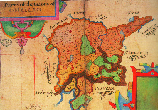
Many other interesting features exist in relation to county boundary history. County Cork originally contained all of Kerry and about one third of Limerick (reflecting the area of the semi-provincial MacCarthy kingdom of Desmond). Then, around 1232, when Kerry was erected into a separate county, its border ran to west of Killarney and Kenmare, both of which, with their hinterlands, remained in County Cork. The modern boundaries of Kerry were only fixed in the early seventeenth century. Originally the province of Connacht contained two counties, Roscommon and Connacht. The former was significantly larger than today, including parts of east Galway and south Sligo, while the capital of Connacht was the town of Loughrea. In the original Norman lordship of Ulster, basically modern Antrim and Down, its de Courci lord adopted a different system to that used elsewhere in Ireland. Here, the original cantreds were erected into small counties, six in all. All of these had two names, that of their chief town and the Anglicised name of the Irish triúcha céad which the Normans had taken over. Among these towns were Down, Newtownards, Carrickfergus, Antrim and Coleraine. The English re-shiring of the Tudor period resurrected just two of these: Antrim alias Mauline, and Down alias Lecale.
Baronies
The modern unit below the county is the barony. This is merely the latest incarnation of a much older unit, known successively as the triúcha céad, the cantred and then the administrative barony. The barony system was largely established by the New English administration planted in Ireland under the Tudor monarch Henry VIII and his immediate successors. The template for this system was the pre-existing barony system as found in the Pale. This in turn had its origins largely in developments occurring during the fourteenth and fifteenth centuries, when the older cantred system was abandoned and local government functions devolved onto pre-existing feudal and seignorial baronies. It is important to stress that this Irish administrative structure, while having much in common with England, had several features unique to Ireland. Originally the ancestral cantred system had been based on the contemporary English hundred system, but again with some differences. Therefore the present barony structure largely became established between 1534 and 1606 (when the final ‘unbaronied’ area in north Wexford acquired its three baronies). By 1606 Ireland was divided into approximately 267 baronies, having earlier had around 180 cantreds.
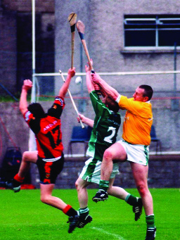
Most of the new baronies were erected upon the existing structure of local lordships, and so merely gave pre-existing divisions and structures a new function. These new administrative baronies (a term used to distinguish them from the much rarer feudal baronies, an entirely different and unconnected entity) were used as the basic unit of tax collection and the administration of justice, just as had the local lordships upon which they were based. Local taxes were levied by barony, and the sheriff’s tourn, the lowest court of royal justice, held in each. Later the tourn was replaced by the quarter sessions, which fulfilled the same function. On the civil front, sporting activities were often organised by barony, such as football and hurling matches.
During the sixteenth and seventeenth centuries some commercial activities subject to government licence had been franchised by barony, while from 1821 onwards census records were organised and collected by barony. Reforms of the 1830s saw much of the taxation function of baronies transferred to the new Poor Law unions, organised around towns, and at the same time barony borders were extensively redrawn and tidied up. Baronies considered to be too large were divided into sections such as ‘north’ and ‘south’, ‘upper’ and ‘lower’, and so on. This reform raised the number of baronies to around 322.
Fraudulent titles
The remaining functions of the barony were abolished by the local government reforms of 1898, which established the current county council system. Today such units only hit the headlines when the title to ‘baronial lordship’ is purchased. Such titles are completely fraudulent and the result of a clever scam whereby largely English-based ‘auctioneers’ peddle titles to purported ‘feudal baronies’ which in reality refer to administrative baronies, a completely different unit. This is on a par with selling the ‘lordship’ of an electoral constituency, county council or health authority. Feudal baronial titles in the Republic of Ireland were legally extinguished decades ago and simply do not exist anymore, but fools and their money are, it seems, easily parted.
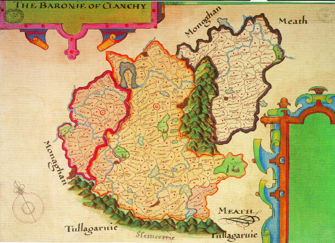
Many baronies date from the sixteenth century and so preserve contemporary political divisions, while a lesser number date from as late as the 1830s and so have little historical relevance. Some, however, are much older and descend intact from the Anglo-Norman cantredal system. The baronies of County Louth preserve the shape of the original twelfth-century cantreds, which, in turn, are based on even older indigenous spatial units. Something similar can be said for the baronies of Donegal, west Clare, south Wexford and most of Mayo and Sligo. In Meath, Westmeath, Kildare and Dublin the baronial structure is based on a twelfth-century substructure that existed under the cantreds of these counties and was based on feudal baronies and seignorial manors, sometimes in turn based on pre-Invasion indigenous túatha. Some baronies preserve the names of ancient polities, such as Shillelagh (Síl nÉlóthaig), Carbury (Cairpre), Fartullagh (Fir Thulach), Shelburne (Síl mBriain) and Ferrard (Fir Arda Ciannachta) in Leinster; Lecale (Leth Cathail), Tirhugh (Tír Aedh), Iveagh (Uíbh Echach Cobo) and Keenaght (Ciannachta Glinne Geimin) in Ulster; Leyny (Luigne Connachta) and Carra (Cera) in Connacht; and Fermoy (Fir Maige Féne), Imokilly (Uí MacCaille) and Eliogarty (Éile Uí Fhócarta) in Munster. These names preserve the memory of ancient kings and polities: Élóthach was a king of Uí Chennselaig who died in 732, Cathal was an Ulster king who lived in the same century, while the O’Fogartys were kings of Éile before the Norman invasion. Fir Thulach, Fir Arda and Ciannachta were polities first recorded in the sixth century, Fir Maige in the seventh. The Tipperary barony of Owney preserves the name of the Uaithne people, first recorded on Ptolemy’s second-century map of Ireland.
Derived from sixteenth-century circumstances
Many baronial names and shapes derive from sixteenth-century circumstances, and often bear the names of the local lordships upon which they were based. Among these are Clanmaurice (FitzMaurice), Condons and Clangibbons (FitzGibbon), and Clanwilliam (Burke) in Munster; Clandonagh (FitzPatrick) in Leinster; Costello and Clanmaurice (Prendergast) in Connacht; Oneilland, Clanmahon (O’Reilly) and Clankee (O’Reilly) in Ulster. Other baronies preserve the extent of sixteenth-century lordships but merely bear the name of their chief place, such as Tiaquin in Galway, the chief castle of its O’Kelly lords, and Dunkerron in Kerry, named from an important O’Sullivan stronghold. Sometimes the older cantred names are retained but now apply to sixteenth-century units markedly different in shape from their ancestors. Such is largely the case in County Carlow, where the baronies, despite bearing the names of the earlier cantreds, represent the sixteenth-century sub-lordships of the Kavanagh lineage, which bear only a loose approximation to the earlier cantreds. Sometimes an innocuous name preserves an ancient history. The barony of Ballynahinch in Galway preserves exactly the shape of the older cantred and triúcha céad of Conmacnemara or Conmaicne Mara, a kingdom first mentioned in the annals sub anno 660.
In south Connacht the New English administration deliberately abandoned the old territorial names when erecting the baronial system during the 1570s. Some of these names refused to die, however—for example Connemara, derived from this ancient unit but now colloquially applied to a much larger area. (Today ‘Connemara’ refers to everything west of Galway city. As recently as 1922, however, in the Times Atlas of the World, one finds the true historical situation reflected, where ‘Connemara’ only refers to everything west of Ros Muc. East of this lay the medieval Gnó Mór and Gnó Becc, whose shape is preserved in Moycullen barony and which descend from the ancient kingdom of Delbna Tíre dá Locha, ‘the Delbna of the land of the two lakes’.) The barony of Kilmacrenan in Donegal preserves exactly the shape of the local kingdom of Cenél Luigdech. Lugdach was a first cousin of St Colm Cille or Columba and thus lived around the mid-sixth century. Among his descendants were the O’Donnell kings of all Tír Chonaill, who had been mere local kings of Cenél Luigdech until the mid-thirteenth century.
For geographical reasons, peninsulas often retain their ancient kingdom names, such as Inishowen (Inis Eóghain), Ards (Uí Echach Arda) and Cooley (Cúailnge of Táin fame). This is not always so, however. In the south-west tourist interests pose the greatest threat to the ancient and beautiful peninsula names Corca Dhuibhne or Corkaguiney (‘the Dingle Peninsula’), Uibh Ráthach or Iveragh (‘the Ring of Kerry’) and Ivagha or Uibh Eachach (‘the Mizen Peninsula’). The destruction of our onomastic heritage in such a grubby, profit-driven way is perhaps best typified by the current controversy surrounding the laudable ministerial efforts to promote the indigenous name, An Daingean, in place of the English-imposed term, Dingle (admittedly a long time ago), for the chief town of Corca Dhuibhne. All is not bleak, however. In recent years the hitherto marked tendency to name new urban housing developments after places in England (‘Shrewsbury Downs’, ‘Oxford Mews’, etc.) has finally begun to abate in favour of Irish forms. There is, perhaps, hope for our ancient onomastic heritage after all.
Paul MacCotter’s Medieval Irish territorial, political and economic divisions will be published by Four Courts Press in 2008.