If maps could speak
Published in Book Reviews, General, Issue 6 (Nov/Dec 2011), Reviews, Volume 19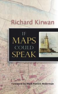
If maps could speak
Richard Kirwan
(Londubh Books, Ä14.99/£12.99)
ISBN: 9781907535093
This book is a tale of maps and a man—of maps because the author spent most of his working life in the Ordnance Survey of Ireland until he retired, having risen through the ranks to become director, but also of the man and his quests, desires and fears, from the time he grew up in Waterford until now, when he has discovered a new vocation: that of being a healer who has a view on life, its pace and values that is quite different from what animated him when he was fired with the notion of updating Ireland’s maps as an essential accompaniment to economic progress. But since this book is essentially a personal, very personal at times, memoir of the author—and to be valued and respected as such—does it merit notice from historians?I have found over the years that there are very few historians who do not have some feeling for maps. Historians have maps on their office walls, they use them in their lectures and publish them in their writings—imagine an issue of History Ireland without a map! For the most part, this relationship with maps is presented in functional terms: one needs them to understand where a battle was fought or the distribution of some phenomenon or other. But while maps are functional objects—whether for planning infrastructure, travelling or teaching—they are also objects that we relate to and which captivate us: there is something attractive about staring at a map and seeing how all the bits of information it records relate to one another. Even when it has no explicit decoration a map can be a work of art. Viewed in this way, the map can recall memories, evoke emotion and become something far more within our understanding than an information vector. This book is just such a celebration, as the author recalls his emotional involvement with maps from his childhood—but one senses a tension throughout between his emotional attachment to maps, what they evoke, ancient boundaries and placenames, and the functionalist vision of cartography that drove him onwards within the Survey and his ‘mission’ to produce the new maps needed by the Ireland that became the ‘Celtic Tiger’ and to introduce the new GPS–GIS technology that has transformed cartography forever.The book is also a celebration of the memory of the Survey, going back to Col. Thomas Colby and the sappers and scholars who made the Irish survey a model for imitation in the nineteenth century. It has become fashionable to decry the Survey in recent years using a post-colonialist critique, but this fails to note that without the Survey not only would Irish administration have been much worse but vast amounts of cultural information would have been lost, and there would not have been as valuable a legacy to the new state in 1922. This book is a celebration of all that work, and of the men—they were all men—who kept the Survey alive through the hard economic times up to the 1980s. It is a memoir of a past world, but the skill and dedication of those generations who followed from Colby’s time until the rise of digital cartography should not be forgotten.This book is a memoir, a reminiscence and a deeply personal journal of a life: the Waterford boy, the engineer, the (reluctant) army officer, the mapmaker, the bureaucrat and, now, the healer. It scotches completely the trite old saying, ‘Geography is about maps, history is about chaps’. This is a book about maps, chaps, memories and much more besides—and reminds us that history is an enveloping discipline. HI
Thomas O’Loughlin is Professor of Historical Theology at the Department of Theology and Religious Studies, University of Nottingham.